Thursday, May 31, 2018

KRUSE RHODODENDRON STATE RESERVE


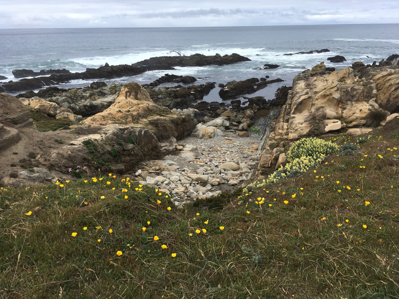
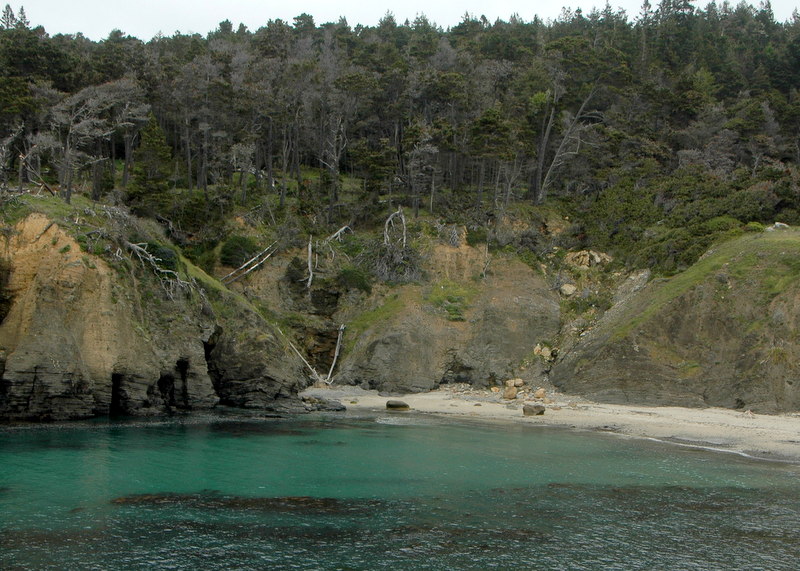
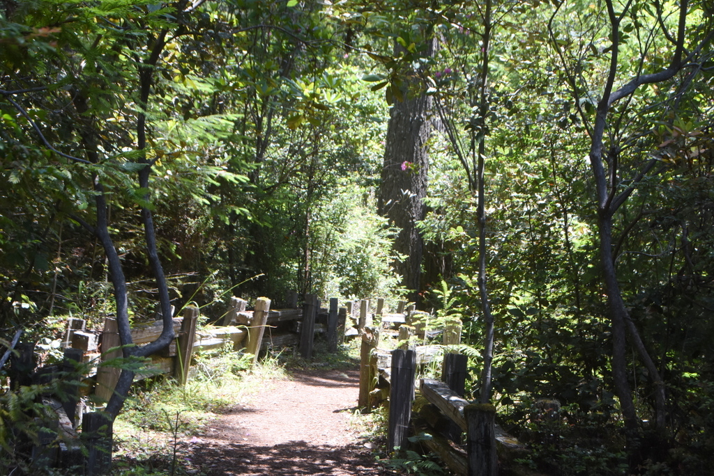
Carpool at 9:45 at pullout for Gualala business directory north of bridge, or at The Sea Ranch Lodge at 10:00. Shortly after entering Salt Point State Park, drivers from the north should prepare to turn left on Kruse Ranch Road, just before Fisk Mill Cove. There is just a short drive to the official parking area. No fees and no passes required. Hike will begin from the Kruse parking area at 10:15. We will hike the short Rhododendron trail connecting with Phillips Gulch Trail and return on the Chinese Gulch Trail. This is only a 2.5 mile hike. The first part is mostly up and the second part is mostly down (but no steep places). Fortunately, there are level places along the way where we can catch our breath. We will cross eight bridges over flowing creeks. This is a spectacular area. If the Rhododendrons are still in bloom we will have time to appreciate them and we often see Coralroot orchids and sometimes late flowering Calypso orchids in May. Lunch will be on some friendly logs near our starting place. Dogs are not allowed on the Kruse trails.
Leaders: Mary Sue Ittner and Bob Rutemoeller
photos contributed by Bob R, Mary Sue and Harmony

Thursday, May 24, 2018

POMO TRAILS AND SALAL TRAIL


Hike starts at 10:00 from the small parking area east of Highway 1 at mm 58.19. Parking is also available for a fee or with a pass at the Gualala Point County Park across the highway. Pass though gate and walk north on dirt road. Take trail at post 149, continue past trail post 149 to next trail post which is not numbered and turn right. At Deer Trail cross to trail post 148.Hike Pomo Hillside Trail to where it ends on Deer Trail, walk south and turn onto trail at post 146 to the right. Follow the Pomo Creek Trail with its scenic loop, cross Screech Owl, continue trail at post 144, then take the first right to reach Halcyon. Walk west, cross highway, and continue on Halcyon to Leeward Rd. Turn left and at next hedgerow take Helm to the bluff trail. Go north and then walk the Salal Trail to Hidden Parking lot for lunch. Walking sticks may be helpful.
Leader: Adrian Adams
Mileage: 4.4
photos contributed by Harmony & Liberty Laura

Thursday, May 17, 2018

MOAT CREEK #3 ** Note Early Start**


Meet at 7:35 at pullout for Gualala business directory and carpool at Anchor Bay at 7:45 south side of town on west side of highway. Start at Moat Creek at MM 12.77 on way to Pt. Arena at 8:00.  Hike bluff south to Bowling Ball Beach.  Walk south on beach to Schooner's Gulch and then return via beach and bluff to Moat Creek for breakfast. Mostly level, but two short steep stretches (up one way and down another.) The beach can be rocky and a bit challenging to walk on in a few stretches. There is a minus tide this day so we will be starting early to take advantage of this. There are often nice wildflowers this time of the year along the bluff and Schooner's Gulch at a low tide is a sight to behold.
Leader: Mary Heibel
photos contributed by Bob R

Thursday, May 10, 2018

MANCHESTER BEACH, BRUSH CREEK TO LAKE DAVIS (NEW)

Meet at 10:00 at the pullout for the Gualala business directory and at Anchor Bay (west side of Hwy 1) at 10:15. The hike will begin at the Manchester State Beach Parking Lot (end of Kinney Road, just north of Manchester village) at 10:30. We will walk west to the bluff edge and follow a trail through the dunes south passing the AT&T Undersea Cable Station, to access a large field of wildflowers adjacent to the Brush Creek estuary. After exploring the creek and estuary area we will hike north up the beach to the Lake Davis area of the park, where we will circumambulate the environmental campsite. We will return to the beach by way of a lakeside trail, and then south on the beach to the parking lot. Lunch will be at the picnic tables near the parking lot.
Leaders: Jeff Gyving and Lena Bullamore
Mileage: 3.1
photos contributed by Bob & Mary Sue

Thursday, May 3, 2018

SALT POINT LOOP


Carpool at 9:30 at pullout for Gualala business directory north of bridge, and at The Sea Ranch Lodge at 9:45. Park at the call box parking area one-half mile south of Stump Beach on the east side of HWY 1 (south of MM 41.00). Take trail on east side of the highway up to the first fork. Turn right and follow the trail until you come out at the highway. Cross the highway and take the road to the campground (where there will be bathrooms we can use). From there we will hike down the hill turning right on the road to the Visitor Center. Pass it and go onto the headlands. Hike north on the bluff all the way to a rock outcropping in line with the call box on the highway, then continue for another few minutes toward Stump Beach. There we will have lunch seated on some wonderful rock ledges, watch the crashing surf and see the salt pockets after which Salt Point was named at Glen's Spot. After lunch continue on the trail to the Highway and carefully walk back to the cars. Dogs are not allowed on the Salt Point trails. Walking sticks are a good idea. The trail could be a bit wet in spots if we've had recent rain. This is potentially a bit longer hike, but we could have nice flowers and it has both forest and bluff and a wonderful lunch spot.
Leader: Joel Chaban
Mileage: 4.6
photos contributed by: Harmony, Mary Sue & Bob R