Thursday, September 25, 2014

FISK MILL BLUFFS


Meet at 10:00 at pullout for Gualala business directory north of bridge to carpool and at The Sea Ranch Lodge parking lot at 10:15. Start at 10:30 at Fisk Mill Cove (MM 42.63) in Salt Pt. State Park. Park in north parking lot near restrooms. There is now a parking fee to park here so people with passes should bring them. Hike north on the parking lot road to catch the trail to Sentinel Rock. From there take the bluff trail south and hike unbelievably beautiful bluff south to Stump Beach. Don't descend, but turn around and hike back. Lunch will be on some large flat rocks where Phillips Gulch Creek cascades over the bluff. Since we will be crossing two creeks with steep sides, and since there is still a dangerous spot along the trail that has washed out, walking sticks are advisable and good boots. Dogs are not allowed on the Salt Point trails.
Leaders: Ken and Marian Brown

Thursday, September 18, 2014

POINT ARENA PUBLIC LANDS LOOP (new)


photo credit: Bob Rutemoeller
Mary's Meadow
photo credit: Bob Rutemoeller

photo credit: Bob Rutemoeller

Lava Rock


photo credit: Gary Levenson-Palmer
Meet at 9:20 at pullout for Gualala business directory and at 9:30 at Anchor Bay (west side of Hwy 1) to carpool and start at Point Arena City Hall at 10:00. Walk north until you reach a road that will lead you to the bluff and spectacular ocean views. Follow the bluff for a while, stopping at the picnic tables for lunch before returning to the cars. This is mostly coastal grassland so there isn't much elevation change, but the ground is uneven and there are gopher holes so good hiking shoes are helpful.  Leader: Mary Heibel

Thursday, September 11, 2014

HUGEL/SAG POND/LONGMEADOW LOOP (new)


Carpool at 9:45 at pullout for Gualala business directory north of bridge or meet at 10:00 at Ohlson Rec Center (just south of the white barn). Hang tags needed. Cross the highway and take the Hugel RavineTrail to Seabird Road. Pick up the trails again at the end of Schooner Dr (post 109) and follow the Sag Pond Trail to Longmeadow Rd. Walk down Longmeadow to Greencroft Close and pick up the trails again at the end of Greencroft (post 238). Walk down the Longmeadow Trail, around the stables and end up back at Ohlson Rec Center. Lunch there or at Ohlson Beach.
Leader: Theresa Yuen  (The consensus was that this is a hike worth repeating!)

NOTE: We had guest hiker and artist Brandy Gale with us on this hike. Brandy will be having a show at the Gualala Art Center coinciding with An Artistic Celebration of RCLC's Public Access.   (co-curated by Thursday Ramblers' own Mary Sue and Harmony) Mark your calendars for Friday, January 9, 2015!

Thursday, September 4, 2014

SOUTH GERSTLE COVE BLUFF - "THE SLEEPING LION"


photo credit: Bob Rutemoeller


photo credit: Bob Rutemoeller
The Sleeping Lion
photo credit: Bob Rutemoeller
Carpool at 9:45 at pullout for Gualala business directory north of bridge and at The Sea Ranch Lodge at 10:00. Drive almost through Salt Point to MM 39.17 where there is a wide area to park on the right side of the road.  At 10:15 cross over to the gate on the east side of the 
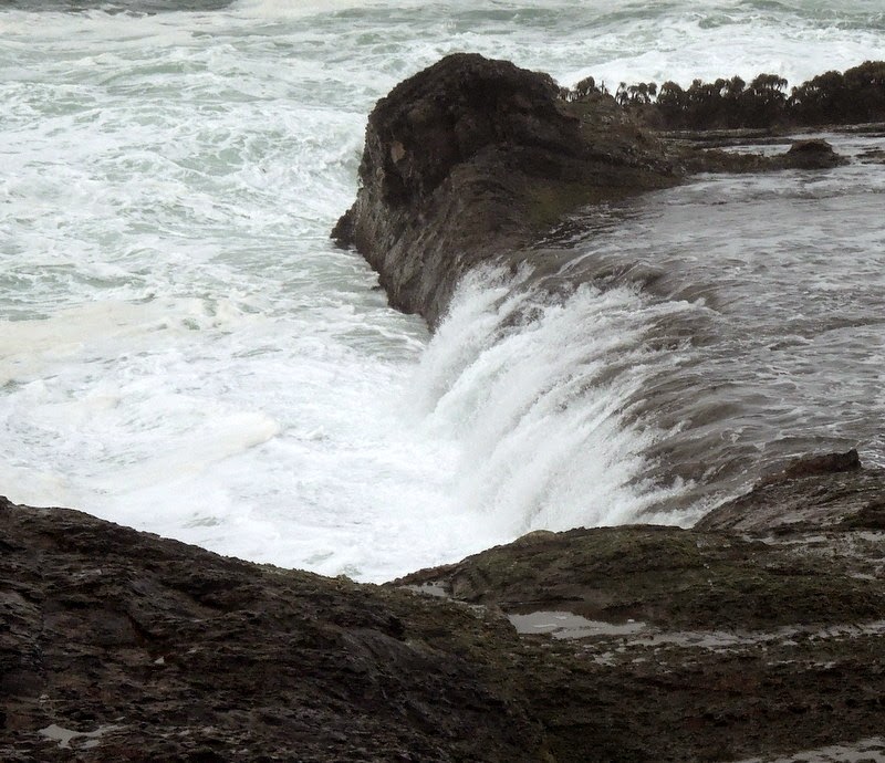
road and follow a path north, parallel with the road. Cross the road at MM 39.4 continuing north until we pass the waterfall.  Follow the trail south to the South Gerstle Cove Picnic Area. From here we will follow the bluff as closely as possible until we reach the extreme southern boundary of Salt Point Park. We will return to our cars the same way we came. The rock formations and views from the bluff are outstanding. Just one warning: the paths are rough and eroded in places, and there are a few steep gulches to cross. The trail is not maintained, and disappears in some places. We will take a very leisurely pace and explore whatever attracts our attention. Be sure to bring walking sticks and be ready to lend a helping hand to your fellow hikers. There are several nice places to sit on the ground overlooking the ocean and have lunch, or we may wait until we return to the picnic area at South Gerstle. Our leader will point out a "sleeping lion" rock formation that is most visible on a sunny day at about 11:30. This hike is mostly level, but with obstacles. Dogs are not allowed on the Salt Point trails.
Leader: Harmony

NOTE for next time: Hiking sticks recommended. Harmony inadvertently took several "wrong" trails and we ended up walking on highway 1 for close to a 1/4 of a mile. Recommend parking further north and skipping the east side with it's many (sometimes confusing) trails.