Thursday, September 18, 2014

POINT ARENA PUBLIC LANDS LOOP (new)


photo credit: Bob Rutemoeller
Mary's Meadow
photo credit: Bob Rutemoeller

photo credit: Bob Rutemoeller

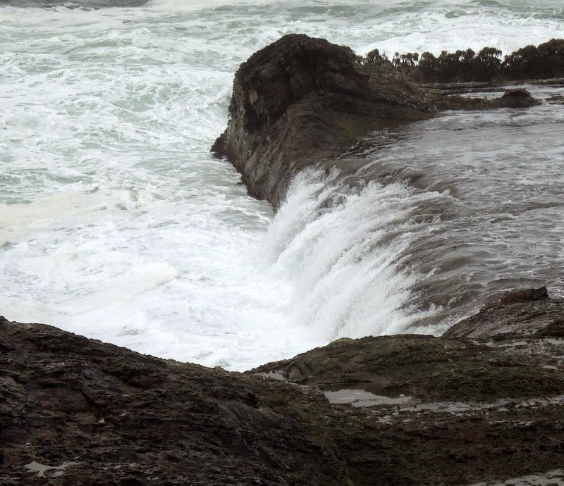
Lava Rock


photo credit: Gary Levenson-Palmer
Meet at 9:20 at pullout for Gualala business directory and at 9:30 at Anchor Bay (west side of Hwy 1) to carpool and start at Point Arena City Hall at 10:00. Walk north until you reach a road that will lead you to the bluff and spectacular ocean views. Follow the bluff for a while, stopping at the picnic tables for lunch before returning to the cars. This is mostly coastal grassland so there isn't much elevation change, but the ground is uneven and there are gopher holes so good hiking shoes are helpful.  Leader: Mary Heibel

Thursday, September 11, 2014

HUGEL/SAG POND/LONGMEADOW LOOP (new)


Carpool at 9:45 at pullout for Gualala business directory north of bridge or meet at 10:00 at Ohlson Rec Center (just south of the white barn). Hang tags needed. Cross the highway and take the Hugel RavineTrail to Seabird Road. Pick up the trails again at the end of Schooner Dr (post 109) and follow the Sag Pond Trail to Longmeadow Rd. Walk down Longmeadow to Greencroft Close and pick up the trails again at the end of Greencroft (post 238). Walk down the Longmeadow Trail, around the stables and end up back at Ohlson Rec Center. Lunch there or at Ohlson Beach.
Leader: Theresa Yuen  (The consensus was that this is a hike worth repeating!)

NOTE: We had guest hiker and artist Brandy Gale with us on this hike. Brandy will be having a show at the Gualala Art Center coinciding with An Artistic Celebration of RCLC's Public Access.   (co-curated by Thursday Ramblers' own Mary Sue and Harmony) Mark your calendars for Friday, January 9, 2015!

Thursday, September 4, 2014

SOUTH GERSTLE COVE BLUFF - "THE SLEEPING LION"


photo credit: Bob Rutemoeller


photo credit: Bob Rutemoeller
The Sleeping Lion
photo credit: Bob Rutemoeller
Carpool at 9:45 at pullout for Gualala business directory north of bridge and at The Sea Ranch Lodge at 10:00. Drive almost through Salt Point to MM 39.17 where there is a wide area to park on the right side of the road.  At 10:15 cross over to the gate on the east side of the road and follow a path north, parallel with the road. Cross the road at MM 39.4 continuing north until we pass the waterfall.  Follow the trail south to the South Gerstle Cove Picnic Area. From here we will follow the bluff as closely as possible until we reach the extreme southern boundary of Salt Point Park. We will return to our cars the same way we came. The rock formations and views from the bluff are outstanding. Just one warning: the paths are rough and eroded in places, and there are a few steep gulches to cross. The trail is not maintained, and disappears in some places. We will take a very leisurely pace and explore whatever attracts our attention. Be sure to bring walking sticks and be ready to lend a helping hand to your fellow hikers. There are several nice places to sit on the ground overlooking the ocean and have lunch, or we may wait until we return to the picnic area at South Gerstle. Our leader will point out a "sleeping lion" rock formation that is most visible on a sunny day at about 11:30. This hike is mostly level, but with obstacles. Dogs are not allowed on the Salt Point trails.
Leader: Harmony

NOTE for next time: Hiking sticks recommended. Harmony inadvertently took several "wrong" trails and we ended up walking on highway 1 for close to a 1/4 of a mile. Recommend parking further north and skipping the east side with it's many (sometimes confusing) trails.

Thursday, August 28, 2014

MANCHESTER STATE BEACH AND THOMPSON HEATHER GARDENS

photo credit: Bob Rutemoeller

Meet at 9:05 at pullout for Gualala business directory and at Anchor Bay (west side of Hwy 1) at 9:15. The hike starts at the public access from Highway One on about mile marker 22.27 at 9:45. We will turn in at Alder Creek Beach Road, then turn directly left and park on the road that parallels Highway One. We will walk to the ocean and then go south on the beach and then return. We will drive to the Thompson garden afterwards for lunch. There will be a little beach walking, but there aren't rocks to scramble over and Manchester Beach is very pretty. The Thompson garden, always wonderful, in August is a feast for the eyes with the heathers in bloom.
Leaders: Mary Sue Ittner and Bob Rutemoeller

Thursday, August 21, 2014

SHELL BEACH #1

All photos by Bob Rutemoeller
Carpool at the pullout for Gualala business directory at 9:50 or meet at One Eyed Jack's parking area at 10:00 a.m. Hang tags needed for non Sea Ranchers. Take trail at Post 37 B to Bluff Top trail. Walk south on the trail to Stengel Beach and return continuing after post 30 on Cormorant Reach until Post 33A and back to the Buff Top Trail. Lunch on Shell Beach or continue past post 36 to One-Eyed Jacks for lunch at the end.
Leader: Linda Kennedy

Thursday, August 14, 2014

POINT ARENA PIER LOOP (new)


photo credit: Bob Rutemoeller
photo credit: Gary Levenson-Palmer

photo credit: Gary Levenson-Palmer

Meet at 10:20 at pullout for Gualala business directory and at Anchor Bay (west side of Hwy 1) at 10:30. Hike starts at Point Arena Pier at 11:00. Hike along bicycle trail to highway one, go up Riverside road admiring the B. Bryan Preserve animals on the way, hike left on Pine Reef road to Linda and Jorge's house, hike around their property, lunch on porch. Then return to PA Pier to collect cars.
Leader: Linda Dorticos

Thursday, August 7, 2014

MONARCH GLEN/WALK-ON BEACH LOOP #3 (new variation)

All photos by Bob Rutemoeller
Carpool at pullout for Gualala business directory just north of bridge at 9:50. Start at 10:00 at the Chapel. Hang tags needed for non Sea Ranchers.  Walk the first part of the Chapel Trail with its great views to post 128, turning left to Leeward Spur, crossing the highway. Turn right on Leeward to Seal Rock Reach and take it to 42B and to the Bluff Trail. Walk south to post 37 through the hedgerow to Monarch Glen. Do the Interpretive Trail catching the trail that parallels the highway and crossing the highway at Bosuns Reach to return to the Chapel for lunch.
Leader: Dard Hunter