Thursday, May 18, 2017

SALT POINT LOOP


Carpool at 9:30 at pullout for Gualala business directory north of bridge, and at The Sea Ranch Lodge at 9:45. Park at the call box parking area one-half mile south of Stump Beach on the east side of HWY 1 (south of MM 41.00). Take trail on east side of the highway taking the first path that veers off to the left. We will do a forest adventure down along a ravine then continue for another few minutes east eventually when the path gets hard to follow we will retrace our steps back to the cars and cross highway 1 through the meadow down to the bluffs. We will walk south and then back north.  Lunch will we will be seated on some wonderful rock ledges, watch the crashing surf and see the salt pockets after which Salt Point was named at Glen's Spot.  After lunch continue on the trail to the Highway and carefully walk back to the cars. Dogs are not allowed on the Salt Point trails. Walking sticks are a good idea. This is potentially a bit longer hike, but it has both forest and bluff and a wonderful lunch spot. If its windy we may do the hike in reverse direction and lunch in the forest.
Leaders: Mary Sue Ittner and Bob Rutemoeller
Mileage: 4.3

Thursday, May 11, 2017

CORMORANT-WALK-ON BEACH LOOP AND POTLUCK


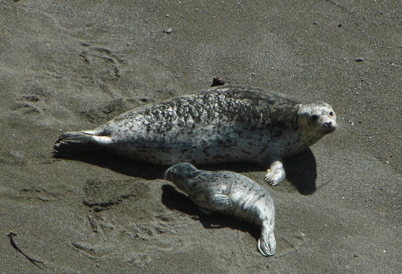
Meet at 9:45 at the Gualala Business Directory (north of bridge) and at 10:00 at Steve and Bonnie Coffeysmith’s house, 339 Bluff Reach, corner of Bluff Reach and Cormorant Close. The hike will end with a potluck at Steve and Bonnie’s so please drop your dish off before we go. Walk to marker 30A and follow the hedgerow to marker 30D. Turn left and follow the trail straight through 31C to 33B. Turn right on Pacific Reach and Whalebone, toward Rt. 1. Turn left at marker 34A, left at 35D, and right at 35C. Continue hiking through the meadows to marker 42C, then turn left and walk to 42, overlooking Walk-on Beach. Turn left and follow the Bluff Trail, passing the TSRA Marine Preserve and Dune Drift Beach at marker 38. Hike to marker 37 and follow the sand trail to the cypress hedgerow, turn right and go to Tidepool Beach to look for harbor seals. Continue on the trail, passing Shell Beach and stopping to check out the cormorant nesting area before returning to the Coffeysmith’s for a potluck lunch.
Leader: Steve Coffeysmith
Mileage: 4.1
photos contributed by Harmony and Bob

Thursday, May 4, 2017

KRUSE RHODODENDRON TO STUMP BEACH (NEW)


Carpool at 9:30 at pullout for Gualala business directory north of bridge, or at The Sea Ranch Lodge at 9:45. NOTE: THIS IS A SHUTTLE HIKE. Shortly after entering Salt Point State Park, drivers from the north should prepare to turn left on Kruse Ranch Road, just before Fisk Mill Cove. There is just a short drive to the official parking area. No fees and no passes required.  After dropping off hikers - 2 (possibly more) cars should drive to Stump Beach and leave enough cars to hold the number of drivers to be picked up at the end at Stump Beach.  Hike will begin from the Kruse parking area. We will hike the short Rhododendron loop while we wait for shuttle drivers to return.  We will proceed up the hill via the Chinese Gulch (or Phillips Gulch) trails continuing up towards Plantation via the road. We will take the Stump Beach Trail (on right) down to Stump Beach where we will lunch either at the picnic tables or at the beach. This is a very beautiful area with the first part of the hike mostly up and the second part mostly down. This is Rhodie season so hopefully we will get to see some of the native Rhododendrons in bloom. Dogs are not allowed on the Kruse trails. Shuttle cars will take drivers back to the start and they will have to return to pick up the riders. This hike has definite elevation change and therefore is one of our more strenuous hikes.
Leaders: Ken & Marian Brown
Mileage: 4.5
photos contributed by Bob, Mary Sue and Harmony

Thursday, April 27, 2017

ALDER CREEK - MANCHESTER STATE BEACH


Meet at 9:05 at pullout for Gualala business directory and at Anchor Bay (west side of Hwy One) at 9:15. The hike starts at the public access from Hwy 1 on about mile marker 22.48 at 9:45. We will turn in at Alder Creek Beach Road, then turn directly left and park parallel to get in as many cars as possible on the road that parallels Hwy 1. We will walk down the road where it is closed until we come to the trail that leads to the environmental campground hoping to see iris, poppies, and baby blue eyes along the way and walk back via the beach if we can. We may change the direction of the hike depending on the wind. We will drive to Beverley Thompson's lovely garden to view spring flowers (Rhododendrons and Azaleas to name a few) and to eat our lunches afterwards.
Leaders: Mary Sue Ittner and Bob Rutemoeller
All photos contributed by Mary Sue

Thursday, April 20, 2017

BLACKPOINT BEACH WALK & BLACKPOINT-BIHLER POINT WILDFLOWER FOOTPATHS


Carpool at the Gualala Business Directory pullout just north of bridge at 9:45, and meet at the Sea Ranch Lodge north (additional) parking lot at 10:00. Walk north from the parking lot to the fire road. Turn left, then right to marker 1. Go down the stairs and walk on the beach to the north end, returning to the stairs (Note: The stairs are steep!). From marker 1, walk south to the first gate marked with the wildflower path marker and follow the path to Black Point, the barn, and Bihler Point. Continue on the marked path toward the Lodge, past the old sheepherder’s cabin, and turn left on the main trail. Follow the Bluff Trail from marker 1 to 3, turn right and continue through the hedgerow to marker 3C, then right on Moonraker to the fire road gate at Black Point Reach. At the end of the fire trail we will go to either the barn or the Lodge chair area for our lunches. Note: If it’s windy, the leader may modify the plan.
Leader: Liberty Laura for Adrian
photos contributed by Bob, Mary Sue, Wildflower Laura and Harmony