Thursday, May 3, 2018

SALT POINT LOOP


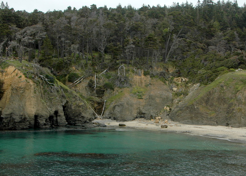
Carpool at 9:30 at pullout for Gualala business directory north of bridge, and at The Sea Ranch Lodge at 9:45. Park at the call box parking area one-half mile south of Stump Beach on the east side of HWY 1 (south of MM 41.00). Take trail on east side of the highway up to the first fork. Turn right and follow the trail until you come out at the highway. Cross the highway and take the road to the campground (where there will be bathrooms we can use). From there we will hike down the hill turning right on the road to the Visitor Center. Pass it and go onto the headlands. Hike north on the bluff all the way to a rock outcropping in line with the call box on the highway, then continue for another few minutes toward Stump Beach. There we will have lunch seated on some wonderful rock ledges, watch the crashing surf and see the salt pockets after which Salt Point was named at Glen's Spot. After lunch continue on the trail to the Highway and carefully walk back to the cars. Dogs are not allowed on the Salt Point trails. Walking sticks are a good idea. The trail could be a bit wet in spots if we've had recent rain. This is potentially a bit longer hike, but we could have nice flowers and it has both forest and bluff and a wonderful lunch spot.
Leader: Joel Chaban
Mileage: 4.6
photos contributed by: Harmony, Mary Sue & Bob R

Thursday, April 26, 2018

BLACKPOINT BEACH WALK & BLACKPOINT-BIHLER POINT WILDFLOWER FOOTPATHS


Carpool at the Gualala Business Directory pullout just north of bridge at 9:45, and meet at the Sea Ranch Lodge north parking lot at 10:00. Walk north from the parking lot to the fire road. Turn left, then right to marker 1. Go down the stairs and walk on the beach to the north end, returning to the stairs (Note: The stairs are steep!). From marker 1, walk south to the first gate marked with the wildflower path marker and follow the path to Black Point, the barn, and Bihler Point. Continue on the marked path toward the Lodge, past the old sheepherder’s cabin, and turn left on the main trail. Follow the Bluff Trail from marker 1 to 3, turn right and continue through the hedgerow to marker 3C, then right on Moonraker to the fire road gate at Black Point Reach. At the end of the fire trail we will go to either the barn or the Lodge chair area for our lunches. Note: If it’s windy, the leader may modify the plan.
Leader: Laura Bridge
Mileage: 3.1
photos contributed by Mary Sue, Harmony and Bob R

Thursday, April 19, 2018

MANCHESTER STATE BEACH AND THOMPSON HEATHER GARDENS


Meet at 9:05 at pullout for Gualala business directory and at Anchor Bay (west side of Hwy 1) at 9:15. The hike starts at the public access from Hwy 1 on about mile marker 22.48 at 9:45. We will turn in at Alder Creek Beach Road which hasn't been marked lately, then turn directly left and park on the road that parallels Hwy 1. We will walk to the ocean and then go South on the beach and then return. We will drive to the Thompson garden afterwards for lunch. There will be a little beach walking, but there aren't rocks to scramble over and Manchester Beach is very pretty. The Thompson garden, always wonderful, is a feast for the eyes with the heathers in bloom. Dogs may not be allowed because of the snowy plovers.
Leader: Bob Rutemoeller
Mileage: 3.8
photos contributed by: Mary Sue, Bob R, and Gary B

Thursday, April 12, 2018

PELICAN BLUFF AND CURLEY LANE


Meet at 10:05 at the pullout for the Gualala business directory and carpool at Anchor Bay at 10:15 at the south side of town on west side of highway. The hike will begin at the Pelican Bluff parking lot at 10:30. The Mendocino Land Trust has designed a 2.2-mile trail and this 73-acre preserve is home to the endangered Point Arena Mountain Beaver and several rare plants, as well as a creek (which is recovering from cattle grazing) and Bishop pine forest. After our hike, we will head over to John and Lynn Walton’s house to enjoy tea and dessert in their garden.  (Note: It was decided by consensus that we would skip Curly Lane add on.)
Leaders: John and Lynn Walton
Mileage: 3.3
photos contributed by Mary Sue, Gary Beall, Gary Levenson-Palmer, and Harmony

Thursday, April 5, 2018

RIDGE, SAG PONDS, BIG TREE AND BIG TREE LOOP TRAILS


Carpool at the pullout for the Gualala business directory just north of bridge at 9:45 a.m. Please bring hang tags for non Sea Ranchers. Going south exit Highway 1 to the left at Deerfield. Go to the top of Deerfield and turn right on Timber Ridge. Start at Big Tree Close and Timber Ridge at Ridge Trail post 122 at 10 a.m. Pass Ridge Trail post 116.  At Ridge Trail post 111 take left fork.  Follow trail to Ridge Trail post 104 at which point you are at Longmeadow Street.  Go through gate and turn right onto Sag Ponds Trail at trail post 104A. Continue on this trail past the Sag Pond to Sag Ponds Trail post 109A.  Turn right and walk to trail post 110.  Turn left on Ridge Trail and walk to trail post 117.  Turn left downhill on Big Tree trail to post 118.  Continue downhill now on Big Tree Loop trail and walk to trail post 267.  Here there is a bench with a great view.  Time for lunch.  After lunch at trail post 267 take a left turn and hike to Big Tree Loop trail post 120. Turn left and exit the Big Tree Loop Trail at Big Tree Close at trail post 123.   Turn right and return to parking area on Timber Ridge. April can be a good time to see Calypso orchids.
Leader: Adrian Adams
Mileage: 5.5