Thursday, November 9, 2023

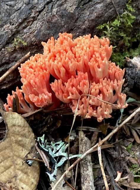
KRUSE RHODODENDRON STATE RESERVE MUSHROOM HIKE


Carpool at 9:45 at the pullout for the Gualala business directory north of bridge, or at the Black Point Beach Coastal Access parking area 10:00. Shortly after entering Salt Point State Park, drivers from the north should prepare to turn left on Kruse Ranch Road, just before Fisk Mill Cove. There is just a short drive to the official parking area. No fees and no passes required. Hike will begin from the Kruse parking area at 10:15. We will hike the Phillips Gulch Trail and return on the Chinese Gulch Trail.  The first part is mostly up and the second part is mostly down (but no steep places). Fortunately, there are level places along the way where we can catch our breath. We will cross eight bridges over flowing creeks. This is a spectacular area.  If you have either of David Arora's mushroom guide books, bring them.  We will look at mushrooms in general but specifically for oyster mushrooms.  Boots and hiking sticks are recommended.  Light rain does not cancel this hike.  Lunch will be on some friendly logs near our starting place. Dogs are not allowed on the Kruse trails. The route of the hike may be altered during the hike depending on time.
Leader: Joel Chaban, 884-9280
 
Photo credit: Laura & Dave

Thursday, November 2, 2023

PELICAN BLUFF


Meet at 10:00 at the pullout for the Gualala business directory and carpool at Anchor Bay at 10:15 at the south side of town on west side of highway. The hike will begin at the Pelican Bluff parking lot at 10:30. Please carpool if at all possible as there is limited parking. The Mendocino Land Trust has designed a 2.2-mile trail and this 73-acre preserve is home to the endangered Point Arena Mountain Beaver and several rare plants, as well as a creek (which is recovering from cattle grazing) and Bishop pine forest. We will start our hike with the trail that goes to the bluff and then South, retracing our steps back to the parking area. After that, we’ll hike the loop that goes North and then down to the bluff, and finish up with the short loop in the center, eating lunch at the picnic tables.
Leaders: John and Lynn Walton, 884-9714

 Photo credit: Laura & Dave

Thursday, October 26, 2023

GUALALA ROAD TO GREEN IRON BRIDGE AND GAC HIKING TRAILS


GUALALA ROAD TO GREEN IRON BRIDGE AND GAC HIKING TRAILS
Meet at 10:00 in back part of the Gualala Arts parking lot. We will walk one of the new GAC trails before hiking along the road down to the green bridge and back. There are some mild elevation changes. We will have lunch at the picnic tables at the Arts Center, and after lunch those interested can view the art shows inside. There are some mild elevation changes on this sometimes shady road that follows the Gualala River.

Photo Credit: Laura & Dave

Thursday, October 19, 2023

MONARCH GLEN/WALK-ON BEACH LOOP


Carpool at pullout for Gualala business directory just north of bridge at 10:50. Start at the Sea Ranch chapel, mm 55.66 at 11 am. Hang tags needed for non Sea Ranchers. Carefully cross the highway to Bosuns Reach. Enter trail on south side, then take a right onto trail going north. Before entering the hedgerow walk the Monarch Glen loop trail on the right, returning to the previous trail. Walk through the hedgerow then turn east onto Leeward Road. When Meadow trail is too muddy walk Leeward Road all the way from the hedgerow. Take a left on Seal Rock Reach and hike to Walk-On Beach for lunch. Proceed on the trail through hedgerow at post 37, then turn east, cross Leeward and retrace steps to chapel.
Leader: Stephen O’Leary, 707-787-0356

Thursday, October 12, 2023

CRISPIN LANE

(Hike Cancelled)

 Meet at 9:20 at pullout for Gualala business directory and at 9:30 at Anchor Bay (West side of Hwy 1) to carpool. We will drive to Crispin Lane in Manchester, parking at the Manchester Community Center/Garcia Guild (formerly the Grange, or perhaps it is the Grange again!) and walk to the end of this county road. Hike starts at 10:00 a.m. We will pass green fields and have lovely views of the ocean on our way back. This road starts out relatively flat and then goes slowly up so we'll coast on the return trip. Afterwards we will have lunch outside at the Manchester Community Center. NOTE: There are often loose dogs on Crispin Lane so you may not want to bring your dog.
Leader: Mary Heibel, (707) 882-2055

Thursday, October 5, 2023

DEL MAR WANDERING


Meet at 9:45 at pullout for Gualala business directory north of bridge to carpool or at the Del Mar Center at 10:00. Hang tags are needed for non Sea Ranchers. Go North on Leeward to Tall Grass, then take the trail that parallels Tall Grass to post 138A. Turn left on the cart path to the edge of the golf course and follow the trail down to Leeward. Take the trail through the hedgerow alongside Helm to Del Mar Point. Turn right on Del Mar Point to post 60C then take the Del Mar Meadow trail north to the intersection with the Bluff Trail at post 63. Go a few steps north on the Bluff Trail, turn right onto the Fish Rock hedgerow. Follow this trail to post 64B and turn left on Grey Whale at post 67B. Follow down to the Bluff Trail at post 67 and make a left on the Bluff Trail and continue south to post 49. Turn left to post 49A, then up Tide Pool and Seadrift to Leeward Road. Go left on Leeward to return to the Del Mar Center for lunch.
Leader: Laura Bridge, 408-306-5321

Thursday, September 28, 2023

OCEAN RIDGE, BOWER PARK AND AIRPORT


We will meet at 9:45 at the Gualala Business Directory to carpool and at 10:00 at Ocean Ridge Park (38381 Ocean Ridge Drive) by the information kiosk (parking area is to the left of the kiosk when you enter from ORD). There is a sign for the park at the Ocean Ridge Drive entrance off Old Stage Road closest to the park (the Ocean Ridge Drive turn closest to Highway 1) and a sign at the park entrance (first driveway on the right after turning onto Ocean Ridge Drive). We will do a loop of the park perimeter and then cris-cross through the park to highlight key features. We'll then journey over to Bower Park and loop through its key features before walking along Old Stage Road to the Ocean Ridge Airport (E55). We will walk adjacent to Runway 31 and past the Pilot's Lounge, then walk along Ocean Ridge Drive to the "shortcut" back to the Ocean Ridge Park. We will loop through the park again past the Petanque court following some of the disc golf holes, back up the driveway to the meadow for lunch at the picnic tables. The hike is a little under four miles but it is a little hilly in sections (no major incline/declines but a good bit of up and down due to the terrain).
Leader: Beth Roland

Links: 

Ocean Ridge Park:
Ocean Ridge Park (managed by Redwood Coast Recreation Center or RCRC): http://rcrcoceanridgepark.org/
There are photos of the pavilion we would like to build, historical and other information (including photos of Petanque balls) and there is a link to donate if you are so inclined (it is a non-profit). There are also secure donation boxes on site (at the Bower Park entrance/first hole of the Disc Golf course and also now on the information kiosk in the meadow).
The listing for Ocean Ridge Park on Disc Golf Scene: https://www.discgolfscene.com/courses/RCRC_Ocean_Ridge_Park
Mendocino Coast Recreation and Park District: https://www.mendocoastrec.org/
Bower Park:
Also the “Fix Bower Park” Facebook group if you are interested in joining that one: https://www.facebook.com/groups/564047289043197
There was an update from the meeting with the county in last week’s ICO.
Bower Park falls under the jurisdiction of the county while Ocean Ridge Park is part of the Mendocino Coast Recreation and Park District (but is a non-profit entity that is run by the RCRC board which is comprised of local members).
Airport:
E55 (Echo 55) is the numerical representation of Ocean Ridge Airport. The website history section has some interesting information and the blog portion has current info. There is also a link to donate (not a non-profit so not tax deductible but it does help keep the airport open and running) – also an appeal from when the closure was threatened in 2014 (and the value add to the community, which we saw in action in January when it became a mobile operating base for PG&E to restore power to the community).
Also the webcam for several of the local airports including E55: https://www.webcamwx.com/index.php
You can scroll through different angles. Checking multiple local areas gives good insight into the current weather conditions/patterns (very useful for pilots).
If you know a plane’s tail number (which is prominently displayed) then you can enter it into Flight Aware and track basic information and flight info:
E.g. N1484S is our plane’s tail number (and Mike usually flies in Thursday evenings and out on Sunday or Monday) so you can see recent flight history and registered (public) information about the aircraft.
(note: the live flight tracking is useful for commercial air travel as well!! https://www.flightaware.com/live/  It’s also just kind of fun to see air traffic in different areas.)