Thursday, January 25, 2018
STORNETTA - POINT ARENA PUBLIC LANDS
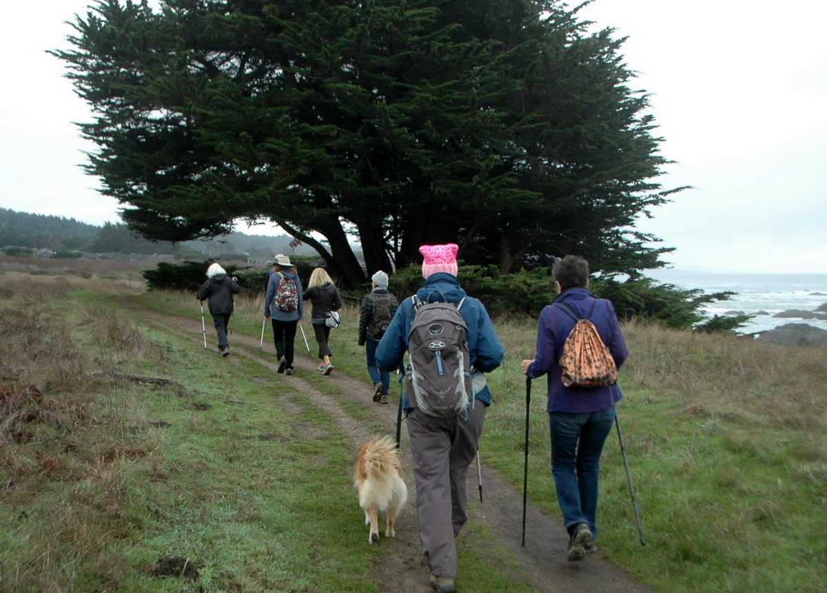
Meet at 9:50 at pullout for Gualala business directory and at 10:00 at Anchor Bay (West side of Hwy 1) to carpool or at the entrance to Stornetta Public Lands where Lighthouse Road turns right towards the Lighthouse at 10:30. Walk the spectacular bluff toward the old Coast Guard Loran site (now owned by Mendocino Community College) seeing blow holes, sink holes, islands, waves and enter the public lands to view this spectacular spot. After we have walked about an hour, we will turn around and retrace our steps finding a suitable spot for lunch along the way. Note that much of this hike is on uneven ground that has been grazed so you have to watch where you step. NOTE: Due to the rains this hike was changed to walking north to the river and eating at the gazebo at the lighthouse.
Leaders: Jeff Gyving & Lena Bullamore
Mileage: 4.0
photos contributed by Bob & Harmony
Thursday, January 18, 2018
SALT POINT BLUFFS - RAIN CHANGED
RAIN CHANGED HIKE TO: Four hardy hikers met up at The Sea Ranch Lodge this morning and opted to hike north along the bluff trail instead of driving to Salt Point. The waves were huge and interesting to watch. We went as far north as Pebble Beach. The big redwood log we used to sit on for lunch was being tossed around in the surf. Adrian was thinking of trying for a "ride", but we talked him out of that.
Photos contributed by Bob Rutemoeller
Thursday, January 11, 2018
BLUFF/MONARCH GLEN/CHAPEL TRAIL/BLUFF
Carpool at pullout for Gualala business directory just north of bridge at 9:50. Start at 10:00 at the parking area at Piper's Reach. Hang tags needed for non Sea Ranchers. Walk to the bluff and then walk south to post 31. Continue east to Cormorant Close and through the hedgerow intersecting the trail that is adjacent to Hwy 1. Walk north on it until you reach the Monarch Glen Trail. Do that loop and then walk back to Bosuns Close and carefully cross the highway taking the road to the Chapel. Walk the first part of the Chapel Trail with its great views to post 128, turning left to Leeward Spur, crossing the highway again. Turn south onto Leeward Road and walk Leeward until you hit trail marker 37 C to 36 C to 36 B with lunch at One-Eyed Jack's or Shell Beach.
Leader: Adrian Adams
Mileage: 5.0
photos contributed by Bob Rutemoeller
Thursday, January 4, 2018
KRUSE RANCH ROAD TO PLANTATION
Carpool at 9:30 at pullout for the Gualala business directory north of bridge, or at the Sea Ranch Lodge at 9:45. Shortly after entering Salt Point State Park, drivers from the north should prepare to turn left on Kruse Ranch Road and drive to the official parking area for Kruse Reserve. There are no fees or passes required. Hike will begin from the Kruse parking area at 10:00. We will hike up the gravel road all the way to Plantation. The ascent is gradual, but the gravel large and often sharp, so sturdy shoes are recommended. In the late nineteenth century, Plantation was an important destination for travelers from San Francisco on their way to Gualala. It had the only hotel available. After we check out Plantation, we will retrace our steps back to the Kruse Reserve for lunch. The views are spectacular. We will walk along several gushing creeks, and have views into deep forested canyons. This hike is a bit longer than our regular hikes, about five miles, but the rewards are great.
Leaders: Mary Sue Ittner and Bob Rutemoeller
Mileage: 5.5
all photos contributed by Bob
Thursday, December 28, 2017
OHLSON RANCH LOOP
Carpool at Gualala Business sign at 9:50 am. Start at Ohlson Ranch
at 10:00am (Sea Ranchers bring hang tags please). Start on trail behind
Ohlson Ranch that parallels Highway 1, connecting with bike path to
Navigators Reach. Turn right onto Navigators Reach and left on Sculpture
Point Drive to end, pick up trail which connects you to Sea Gate Road.
Turn right on Sea Meadow Drive where you pick up the first trail on the
right (marker 7B.) Follow through hedgerow and markers 7C and 7D,
talking trail to connect to bluff trail at marker 8. Head north on
bluff trail until you get to marker 26 where we will turn right and
follow the Breaker Meadow Trail past the Barn back to Ohlson Ranch where
we will have lunch.
Leader: Linda Kennedymileage: 4.8
all photos contributed by Bob Rutemoeller
Thursday, December 21, 2017
SODA SPRINGS RESERVE
Note: If there is heavy rain preceding the hike, an alternate hike may be selected by the leader.
Carpool at the pullout for Gualala Business Directory just north
of bridge at 9:45 and/or at the Sea Ranch Annapolis Road Business Center
at 10:00. Hang tags needed for non Sea Ranchers who park there to
carpool. Park on Kelly Road 1 mile beyond entrance to Annapolis winery
and hike to park. Hike on gravel road 2.3 miles to this 49 acre Sonoma
County Park since 1994 (and known locally as Kelly Park) with lovely old
growth redwoods and stream running by, plus being dog friendly with a
toilet and picnic tables also. Lunch, tour the park, and return. From
the Parks website: "The park is a perfect place to stop among your
travels. Rest or hike under the fragrant shelter of redwood groves,
while enjoying the soothing sounds of running water from the adjacent
Soda Springs Creek. Amenities include picnic areas, restroom, barbecues,
and hiking trails."
Leaders: Mary Sue Ittner and Bob Rutemoeller Photos contributed by Mary Sue and Bob
Thursday, December 14, 2017
CRISPIN LANE AND POTLUCK
This is a potluck so please bring soup, chili or bread to share.
Meet
at 9:20 at pullout for Gualala business directory and at 9:30 at Anchor
Bay (West side of Hwy 1) to carpool. We will drive to Crispin Lane in
Manchester, parking at the Manchester Community Center/Garcia Guild
(formerly the Grange) and walk to the end of this county road. Hike
starts around 10:00 a.m. We will pass green fields and have lovely views
of the ocean on our way back. This road starts out relatively flat and
then goes slowly up so we'll coast on the return trip. Afterwards we
will have a potluck soup and/or chili lunch at the Manchester Community
Center. The crock pots can be going while we hike.
Leaders: Susan and Gary Levenson-Palmerall photos contributed by Bob Rutemoeller
Subscribe to:
Posts (Atom)