Thursday, August 30, 2012

GUALALA ARTS TO GREEN IRON BRIDGE ROAD HIKE

Photo credit: Bob Rutemoeller

Meet at 10:30 in back part of Gualala Arts parking lot. Hike the Gualala Arts trails before or after walking along the road down to the bridge and the end of the county road and back. There are some mild elevation changes. Lunch at picnic tables at the Art Center and a change to see again the Art-in-the-Redwoods exhibits.
Leaders: Harmony Susalla

Thursday, August 23, 2012

MANCHESTER STATE BEACH AND THOMPSON HEATHER GARDENS


Photo credit: Gary Levenson-Palmer
Photo credit: Mary Sue Ittner
Photo credit: Nita Green
If you want to learn more about that super cool spider Gary took a picture of: http://en.wikipedia.org/wiki/Misumena_vatia (Thanks Gary for identifying it for us.)

Meet at 9:05 at pullout for Gualala business directory and at Anchor Bay (west side of Hwy 1) at 9:15. The hike starts at the public access from Highway One on about mile marker 22.27 at 9:45. We will turn in at Alder Creek Beach Road, then turn directly left and park on the road that parallels Highway One. We will walk to the ocean and then go south on the beach and then return. We will drive to the Thompson garden afterwards for lunch. There will be a little beach walking, but there aren't rocks to scramble over and Manchester Beach is very pretty. The Thompson garden, always wonderful, in August is a feast for the eyes with the heathers in bloom.
Leaders: Mary Sue Ittner and Bob Rutemoeller

Thursday, August 16, 2012

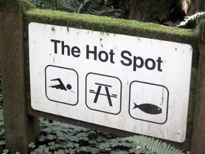
AIRPORT, EARTHQUAKE TRAIL AND HOT SPOT


Photo credit: Gary Levenson-Palmer
Photo credit: Bob Rutemoeller
Meet at 10:15 at pullout for Gualala business directory north of bridge and at 10:30 at the Sea Ranch Business Center on Annapolis Rd. Turn right before the Fire Station on Verdant View. We can park at the end of the cul-de-sac by Sea Ranch Building Supply. Hang tags needed for non Sea Ranchers. Walk north on Timber Ridge Rd., then to the end of Sorcerer Wood. Take trail at post 102, pass 103 and 104. At post 105 take the trail to the left, at 106 a left again to backtrack past 104 to 103. Here take the trail on the left that leads to Ridge Rd. Walk the road down to Deep Woods Dr. on the left. Take this to the end and turn left on River Beach Road. Walk down until the road becomes one way. The start of the San Andreas Fault Interpretive Trail is on the left. After experiencing this guided trail, walk down to The Hot Spot for lunch and afterwards back to our cars via the Hot Spot Loop Trail, River Beach Road and Timber Ridge Rd. Walking sticks recommended.
Leader: Jane Sec

Thursday, August 9, 2012

SOUTH GERSTLE COVE BLUFF - "THE SLEEPING LION"

Photo credit: Bob Rutemoeller
Our Olympic obstacle course
Raven found by Mary Sue
Sleeping Lion
Glen Forbes Bench - A Gentle Spirit
Note: the trail starts at this mile marker
Photo credit: Nita Green


Carpool at 9:45 at pullout for Gualala business directory north of bridge and at The Sea Ranch Lodge at 10:00. Drive almost through Salt Point to MM 39.17 where there is a wide area to park on the right side of the road.  At 10:15 cross over to the gate on the east side of the road and follow a path north, parallel with the road. Cross the road at MM 39.4 continuing north until we pass the waterfall.  Follow the trail south to the South Gerstle Cove Picnic Area. From here we will follow the bluff as closely as possible until we reach the extreme southern boundary of Salt Point Park. We will return to our cars the same way we came. The rock formations and views from the bluff are outstanding. There are great photo opportunities for camera buffs. Just one warning: the paths are rough and eroded in places, and there are a few steep gulches to cross. The trail is not maintained, and disappears in some places. Hiking in Salt Point we are finding is quite an adventure these days. We will take a very leisurely pace and explore whatever attracts our attention. Be sure to bring walking sticks and be ready to lend a helping hand to your fellow hikers. There are several nice places to sit on the ground overlooking the ocean and have lunch, or we may wait until we return to the picnic area at South Gerstle. Our leader will point out a "sleeping lion" rock formation that is most visible on a sunny day at about 11:30. This hike is mostly level, but with obstacles. Dogs are not allowed on the Salt Point trails.
Leader: Gary Sprague

Thursday, August 2, 2012

SOUTH FORK OF THE GUALALA RIVER TO BUCKEYE CREEK aka A VERY BERRY HIKE

Photo credit: Nita Green
Double Gary + Double Ginger!
wild raspberries
wild thimbleberries
wild blackberries

Carpool at the pullout for Gualala business directory just north of the bridge at 10:15 and meet for the 2nd carpool at 10:30 at The Sea Ranch Business Center on Annapolis Rd. (turn right before you reach the Fire Station). We can park along the cul-de-sac by the building supply.  Sea Ranch members please bring along extra hang tags just in case. We will drive to Valley Crossing and park past the second bridge. We will be hiking on a mostly shady logging road walking north on the south fork of the Gualala River to Buckeye Creek where we plan to go down to the river for lunch and then return. This hike is mostly level, about five to six miles total. It's a little longer than our usual hikes but not hard walking.  Hiking on Gualala Redwoods land is usually very peaceful as we rarely encounter anyone and have a feeling of being in the wilderness. This is our once a year hike on their land.
Mary Sue Ittner