Thursday, June 29, 2017
GUALALA POINT PARK #1
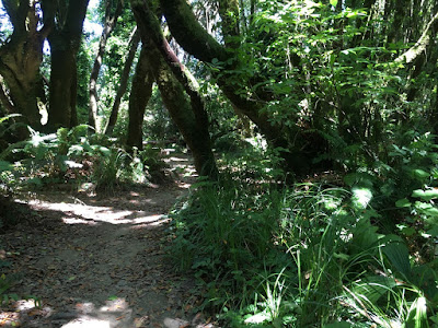
Meet at the Hidden Parking Lot at 10:00 (on westside entrance just left after pulling past fee post.) Or park across the street and cross Hwy 1 if you do not have a pass. Hike to the bluff, go north, and then back to the Visitors Center, walking occasionally on the road, but mostly on trails. After a brief stop on the benches to look at the view of the river, we will take the trail down to the river and under the highway to the campground. From there we will walk through the forest and down to the Gualala River for lunch. After lunch we will walk back to the cars via the road to the campground.
Leader: Harmony
Mileage: 4.7
photos contributed by Mary Sue and Harmony
Thursday, June 22, 2017
BOBCAT/ANNAPOLIS TRAIL
Carpool at pullout for Gualala business directory just north of bridge at 9:45 and meet at the Sea Ranch Lodge at 10:00. We will take the trail from the parking lot to Moonraker Road and cross highway 1. From there we will enter the Bobcat Trail at post 201 and continue to 203 where we will head out on the trail which connects Bobcat to Annapolis Rd trails. (NOTE: There is some elevation change. Sticks are recommended.) At post 203A we will cross highway 1 and head to the bluff where we will circle back, viewing any flowers we may have missed on Bihler and Black Points in the spring. Lunch at Black Point Beach or other suitable spot.
Leader: Laura Bridge
Mileage: 3.8
photos contributed by Steve Coffey-Smith, Bob, Mary Sue and Harmony
Thursday, June 15, 2017
MOAT CREEK #3
Meet at 9:35 at pullout for Gualala business directory and at Carpool at Anchor Bay at 9:45 south side of town on west side of highway. Start at Moat Creek at MM 12.77 on way to Pt. Arena at 10:00. We will be starting early to take advantage of the low tide. Hike bluff south to Bowling Ball Beach. Walk south on beach to Schooner's Gulch and then return via beach and bluff to Moat Creek for lunch. Mostly level, but two short steep stretches (up one way and down another.) The beach can be rocky and a bit challenging to walk on in a few stretches. There are often nice wildflowers this time of the year along the bluff and Schooner's Gulch at a low tide is a sight to behold.
Leaders: Jeff Gyving & Lena Bullamore
photos contributed by Bob and Mary Sue
Thursday, June 8, 2017
HORSESHOE COVE--SALT POINT NORTH - RAIN CHANGE
PLANNED: Meet at 10:00 at pullout for Gualala business directory north of bridge to carpool and at The Sea Ranch Lodge at 10:15. Park at MM 44.00 at Salt Point where we will meet our leader at 10:30. The turnoff is tricky; turnoff at MM44 even though the sign says Turnout 1/4 mile. This hike is quite steep in places so hiking sticks and boots are recommended. Hike on the trail staying right at the fork until you go over the crest of the hill and have a beautiful view of Horseshoe Cove. Descend sharply until you reach the Bluff. Walk south along the bluff until about 11:30 and retrace your steps until we reach a magical rock formation for lunch. The return to the cars after lunch will be uphill, but this is a gorgeous spot so worth the effort.
Leader: Laura Bridge
This was replaced with a Stillwater Cove hike... bluff and wood side. Lead by Mary Sue and Bob.
Photos contributed by Bob and Harmony
Thursday, June 1, 2017
CHAPEL AND AZALEA TRAILS
Meet at 9:50 at pullout for Gualala business directory north of bridge to carpool or at the Sea Ranch chapel at 10:00. Hang tags needed for non Sea Ranchers. Walk north along the Chapel Trail through meadow, forest and ravine. Return on the Azalea Trail, which leads to the Chapel Trail; follow it south back to the Chapel. There are moderate elevation changes on this hike. Those who want to can use the newly installed bench or the rock wall close to the chapel to sit down for lunch at the end.
Leader: Adrian Adams
Mileage: 4.0
Subscribe to:
Posts (Atom)


